

Duchray Hill [Mealna Letter]
Good walks are even better shared.
Overview
Duchray Hill [Mealna Letter]
Duchray Hill, sitting at a modest height of 572 meters, is a perfect spot for both seasoned hikers and those just keen to stretch their legs. Located near Aberfoyle in the Scottish Highlands, this Marilyn presents a unique personality with a stunning backdrop, fantastic views, and a friendly gradient that's not too taxing on the legs!
Geology
The hill boasts a geological story written in basalt and granite - rocks that have withstood the test of time and weather. As you trek up the hill, you may notice fascinating features of erosion and weathered rock faces, with ancient sedimentary layers that whisper of history long past – a natural history book waiting to be read!
Routes
A popular choice is the route starting from Aberfoyle. This 6.5 km path winds through enchanting forests, giving way to expansive views as you approach the summit. Expect to spend around 2.5 hours on this trail, which is moderately challenging. It’s the perfect excuse to take a breather and appreciate the beauty around you.
Summit Features
Upon reaching the summit, you’ll find a classic trig point, standing guard like the proud sentinel that it is. We recommend taking a moment (or two) for a breather and to snap that all-important selfie – after all, it wouldn’t be an adventure without some photographic evidence for the folks back home!
Terrain
The terrain is primarily grassy with a few rocky outcrops, adding a bit of texture to your trek. Just keep your wits about you as you navigate some uneven patches – no one wants to take an unexpected tumble!
Views
Once at the top, we promise the views will make the trek worth every step. You’ll be greeted with stunning panoramas of the Trossachs and even catch a glimpse of Ben Lomond in the distance. To really soak in the scenery, aim for a visit in spring or early autumn when the colours are vibrant and skies are clearer than your morning coffee!
Hazards
As with any good adventure in Scotland, be mindful of the weather. Conditions can shift in a heartbeat, so make sure you’re well-prepared for both sun and rain!
Nearby Summits
If you're feeling ambitious, consider adding nearby Ben Venue to your itinerary; at 729 meters, it can complete a splendid day in the hills!
Access
Parking at Aberfoyle is convenient, and from there, you can easily reach the trailhead. If you’re relying on public transport, fear not – buses from Stirling ensure you can join the fun without the need for wheels.
Facilities
After your hike, pop into one of Aberfoyle's friendly cafes for a well-deserved refreshment. The town is equipped with toilets, so you can freshen up before the journey back.
History
The name 'Duchray' likely translates to 'the place of the fort' from Gaelic, hinting at an intriguing past. Nestled within Trossachs National Park, this hill is a cherished gem, attracting outdoor enthusiasts and nature lovers alike, who marvel at its beauty.
Overall, Duchray Hill is a delightful hike that mixes stunning scenery, a taste of geological history, and a bit of a workout. So lace up those boots, pack a flask of tea, and get going on your adventure!
Explore routes near Duchray Hill [Mealna Letter]
Public walks starting within 80 km of this hill. Nearby does not mean a route reaches the summit; check its map and access before setting out.
Unled club outing: Glenesk (coach departure)
View route
Unled club outing: Xmas Walk - Bankfoot - Dunkeld (coach departure)
View route
Unled club outing: Angus coastal walk (coach departure)
View route
Unled club outing: Glen Moy/Glenogil (shared-car departure)
View route
Route planning notes
These notes describe possible approaches, not verified navigable routes or permission to cross land. Check current paths, local access rules and conditions before setting out.
From Aberfoyle
A scenic trail starting near Aberfoyle, winding through lush forests before ascending to the summit.
Make a day of it, together
Find someone to share the walk with, or organise a day out along a route you like.
Photo Gallery
View all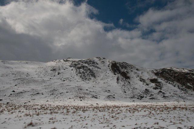 Photo could not load
NO1667 : Mealna Letter from the Glen Beanie path
Becky Williamson
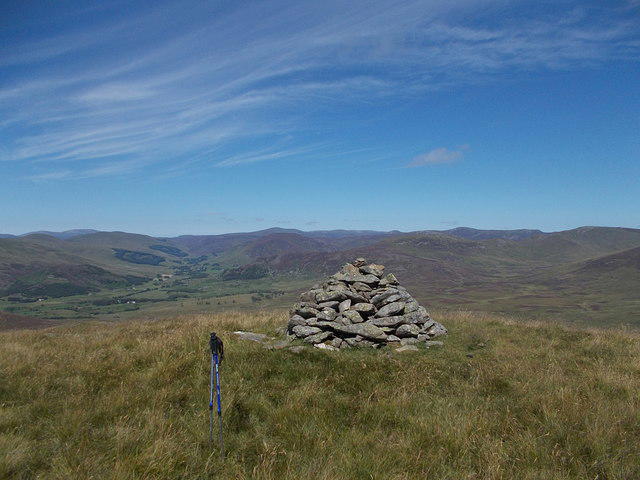 Photo could not load
NO1667 : Cairn on Duchray Hill
Iain Russell
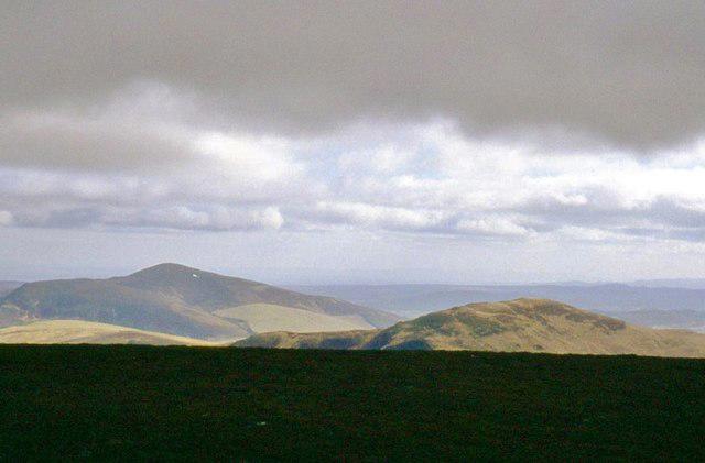 Photo could not load
NO1667 : Mealna Letter and Mount Blair
Alan Reid
Hill facts and local notes
Classifications
Elevation
703m
2,307 ft
Prominence
265m
Coordinates
56.7893, -3.3742
NO161672
OS Map
43
Explorer: OL52S 387S
At the Summit
The summit is marked by a trig point and a small cairn, offering a perfect spot for a well-earned rest – just don’t forget to take a selfie!
Terrain & Geology
Duchray Hill is primarily composed of basalt and granite, typical of the volcanic rock formations found in the region, with fascinating features including weathered rock faces and ancient sedimentary layers that tell tales of geological history.
Views & Scenery
Breathtaking views of the surrounding Trossachs and the distant Ben Lomond; on a clear day, it feels like you can see forever!
History & Heritage
Name Origin
The name 'Duchray' is thought to derive from Gaelic, meaning 'the place of the fort', hinting at a storied past.
Historical Significance
The area holds cultural significance, being part of the Trossachs National Park, a hotspot for outdoor enthusiasts and nature lovers.
Getting There & Facilities
Check current local access restrictions, parking rules and transport timetables before travelling. These notes do not confirm public access to the summit.
Parking
There is parking available at Aberfoyle, with facilities nearby for refreshments after your hike.
Public Transport
Buses run regularly from Stirling to Aberfoyle, making it accessible without a car.
Nearby Facilities
Aberfoyle has cafes, shops, and public toilets; a great place to refuel before or after your adventure.
Safety Information
Known Hazards
- Variable weather conditions can change quickly; be prepared for everything from sunshine to sudden downpours.
General Safety Tips
- Check weather conditions before setting out
- Carry appropriate clothing and equipment
- Let someone know your planned route
- Take a map, compass, and GPS device
- Carry emergency supplies: food, water, first aid kit, torch
Hills
Some common questions about the hills answered
Are there group walks up Duchray Hill [Mealna Letter]?
Many walkers use Walkmates to join or organise walks with others. You can check for group walks around Duchray Hill [Mealna Letter] through the maps
Are there other walkers around Duchray Hill [Mealna Letter]?
Activity varies by location and time, but Walkmates lets you see whether others have shared walks or shown interest in this area. Find other people through the walking friends search walking friends for Duchray Hill [Mealna Letter] search or of course create your own walk for Duchray Hill [Mealna Letter]
Can I organise a walk to Duchray Hill [Mealna Letter]?
Yes. If there aren’t any walks listed already, you can create a walk and make it available for others to join.
If you're signed up to Walkmates, you can create a walk to Duchray Hill [Mealna Letter].
How do I find a walk up this hill?
There are often multiple ways to walk this hill, depending on experience and route preference. Walkmates helps you explore walks and routes that others have shared.
Can I suggest a new route up Duchray Hill [Mealna Letter]?
Yes. You can suggest or create routes to share with others. Walkmates focuses on the social side of walking, so routes are used to help people organise walks and explore areas together, rather than as detailed navigation tools or route libraries.
Other uses really appreciate knowledgeable walkers sharing their routes. Share your favourite route to Duchray Hill [Mealna Letter] here
The is an error or something incorrect about this hill. How do I let you know?
We always strive to keep the information on Walkmates as accurate as possible. If you find an error, please let us know through the contact form and we'll aim to correct it as quickly as possible
Community Discussion
Comments
Location
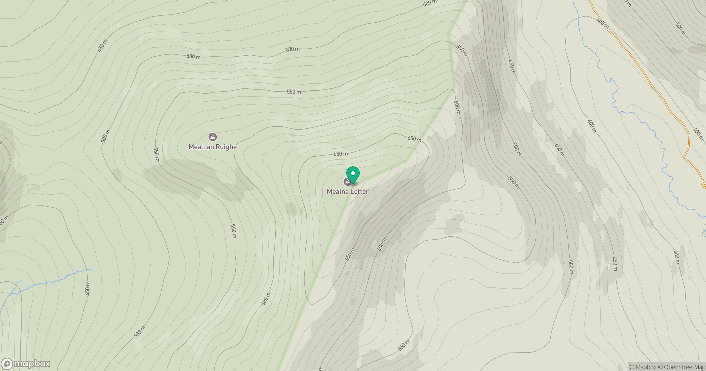
Grid reference: NO161672
View on OpenStreetMapOpens a map in a new tab, centred on the hill.
Hills within 30 km
Straight-line distance, not a walking route or confirmation of access.
Driesh
948m
Lochnagar - Cac Carn Beag
1,156m
Beinn a' Ghlo - Carn nan Gabhar
1,122m
Beinn a' Ghlo - Braigh Coire Chruinn-bhalgain
1,070m
Beinn a' Ghlo - Carn Liath
976m
No comments yet. Be the first.